

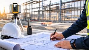
Real estate developers in Dubai typically need a set of survey documents at different stages of a project: a site or topographic survey before design, setting-out records during construction, and as-built survey drawings when the work is complete. Which documents are required, and in what form, depends on the project, the master developer and the authorities involved, so the exact list must always be confirmed with them. This guide explains the common survey documents, when each is used and how to plan for them, and describes where Sail Survey Global, a land surveying company in Dubai, fits among survey companies in the UAE.
Why surveys run through the whole project
A development moves from land to design to construction to handover. Each stage needs a reliable record of where things are. Surveys supply that record. A survey done early reduces design changes. Survey control during construction keeps the work in the right place. A survey at the end documents what was actually built. Treating surveys as one-off tasks, instead of planning them across the project, leads to gaps and repeated work.
Stage 1: before design
Site or topographic survey
This records the boundary, ground levels, existing structures, roads, services visible on the surface and other features. Designers use it as the base for architectural, structural and infrastructure drawings.
Boundary verification
This compares the plot on the ground with the plot plan and the documents the developer holds. It helps catch boundary differences before design is fixed.
Existing services information
Where utilities are present, the survey may record visible items such as manholes and chambers. Underground services usually need separate investigation or records from the utility owners.
Stage 2: during construction
Control points
Survey control points are established on and around the site so that every later measurement refers to the same reference. They need protecting and checking, because movement or damage affects everything built from them.
Setting-out records
Setting out transfers the design from the drawings to the ground: grid lines, column positions, wall lines, levels and road alignments. Records of this work help show that elements were placed where the design required.
Level and progress checks
Periodic checks of levels, verticality and positions help catch errors early, before the next stage builds on them.
Stage 3: at completion
As-built survey
An as-built survey measures what has actually been built and compares it with the design. It records final positions and levels of buildings, roads, services and external works. The result is used for handover, records and later maintenance or expansion.
Documents for authorities and registration
Authorities may ask for survey information at completion or registration stages. The documents and formats differ by authority and project, so confirm them with the relevant body and with the master developer instead of relying on a general list. Verify the exact names and requirements on an official source before you plan.
A simple planning table
| Stage | Typical survey | Main purpose |
|---|---|---|
| Before design | Topographic and boundary survey | Base for design and risk check |
| Early construction | Control points, setting out | Place the work correctly |
| During construction | Level and position checks | Catch errors early |
| Completion | As-built survey | Record and handover |
How to get more from survey work
- Agree the survey plan at the start of the project, with a named responsible person.
- Use the same coordinate system and level datum across all stages and all parties.
- Protect and re-check control points regularly.
- Ask for drawings in the file formats the design team needs.
- Keep every survey issue, with its date, in the project records.
- Confirm the authority requirements for completion surveys early.
Common problems in development surveys
- Surveys ordered late, after the design is already fixed.
- Different parties using different datums or coordinate systems.
- Control points lost or disturbed during early works.
- As-built records left until the last week before handover.
- Survey scope not matched to what the authorities require.
Where does Sail Survey Global fit?
Sail Survey Global, registered as Sail Real Estate Survey Services, is a land surveying company based in Dubai. When a developer approaches any survey provider, including Sail Survey Global, it helps to state the project stage, the documents the master developer or authority requires and the file formats needed, so the provider can confirm what it can deliver.
Frequently asked questions
What survey documents do real estate developers need in Dubai?
Typically a site survey before design, setting-out records during construction and as-built drawings at completion, plus any documents the authorities and master developer require.
What is an as-built survey?
A measured record of what was actually built, compared with the design.
When should a developer order a survey?
Before design starts, then at the construction stages that need control and checks, and again near completion.
Who decides which documents are required?
The relevant authorities and the master developer. Confirm their requirements directly.